
Property Line Markers for a Drought-Tolerant Yard
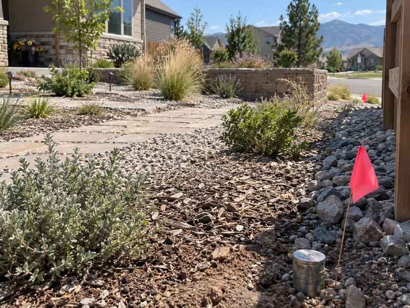
More homeowners are ripping out thirsty lawns for rock beds, native grasses, and drip-irrigated plant beds. It saves water and cuts down on mowing. But before the sod comes out, there is a question many people skip: do you know exactly where your property lines are?
Xeriscape projects often involve digging, grading, and placing hardscape closer to the edges of a lot than a traditional lawn ever did. Without knowing where your boundary sits, you risk damaging a survey marker, building on a neighbor’s land, or losing the reference points you need later. Here is how to protect your property lines while you redesign your yard.
Property line markers are physical points set by a licensed surveyor to show where one property ends and another begins. They can be metal pins, rebar with a cap, or concrete monuments buried at or near the surface. Some are decades old and hidden under grass, mulch, or landscaping rock.
Document Property Line Markers Before Landscaping Begins
Before you break ground on a xeriscape project, find out where your markers are and get them recorded. This protects you if a marker gets disturbed later during digging or grading.
A licensed surveyor can locate existing markers, confirm they match your recorded property lines, and create a simple site sketch showing their exact position. This sketch becomes your reference point for the entire project.
- Marker locations relative to your house and fence lines
- Distances from markers to planned garden beds or hardscape
- Any markers that are missing, damaged, or unclear
Many older neighborhoods have shifted fences, added sheds, or replaced landscaping over the years. This can hide or move soil around original markers without anyone realizing it.
Protect Survey Monuments During Xeriscape Installation
Once you know where your markers are, protect them during construction. Excavation equipment, delivery trucks, and even hand tools can knock a marker out of place or bury it under new gravel and rock.
Mark the location clearly before work starts. A small flag or stake nearby warns crews to dig carefully in that spot.
If a marker does get disturbed or removed during the project, do not try to reset it yourself. Colorado law treats survey monuments as protected points, and moving or replacing one without a licensed surveyor can create boundary disputes down the road. Contact a surveyor to reset it properly and document the new location.
Use Boundary Information to Lay Out Landscape Improvements
Knowing your property lines helps you plan a xeriscape design that fits your actual lot, not just what looks good on paper. This matters most when you are adding raised beds, gravel paths, or plant zones near the edge of your yard.
A boundary survey or a simple property line location gives you real measurements to work from. This helps you:
- Keep garden beds and irrigation lines within your property
- Avoid encroaching on a neighbor’s side yard or shared space
- Plan drainage so runoff from rock beds does not flow onto adjacent lots
Xeriscape yards often use rock, gravel, and hardscape instead of grass. These materials do not absorb water the way turf does, so drainage planning near your boundary lines matters more than people expect.
Check Boundaries Before Adding Walls or Permanent Hardscape
Retaining walls, raised planters, and edging are common in drought-tolerant designs. These are permanent improvements, and placing one on the wrong side of a property line can lead to a costly removal or a legal dispute with a neighbor.
Confirm your boundary before pouring footings or setting wall blocks. This is especially important on corner lots or older lots where fence lines do not always match the recorded survey.
Permit requirements for walls and hardscape can vary by height, material, and location within Denver or surrounding jurisdictions. Check with your local building department early, since some permanent structures require a permit even if they seem small.
Preserve Boundary Reference Points After the Yard Is Finished
Once your drought-tolerant yard is finished, protect the reference points you worked to establish. Rock beds, mulch, and dense plantings can bury a marker just as easily as construction equipment can damage one.
Keep a copy of your survey sketch or marker location report somewhere safe. This gives you or a future buyer a fast way to find boundary points without paying for a full re-survey later.
If you plan future phases of landscaping, fencing, or an accessory structure, this record saves time and helps any surveyor you hire pick up exactly where the last project left off.
Frequently Asked Questions
How do I find my property line markers?
Start by checking your property survey or plat map, if you have one. If markers are not visible or you are unsure of their accuracy, a licensed surveyor can locate and confirm them for you.
What should I do if I can’t find any markers on my property?
This is common on older properties where markers were buried, removed, or never set at the current standard. A surveyor can research the property records and reset markers based on legal descriptions and field measurements.
Can I move a property line marker myself?
No. Survey monuments are legally protected points. Moving, removing, or destroying one without a licensed surveyor involved can create boundary confusion and may carry legal consequences.