
The Alley Disappeared, but the Property Question Did Not
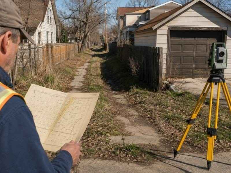
City alleys vanish quietly. A garage gets built across one end, a fence closes the other and within a generation the corridor exists only on paper. Then a property sells, a title company asks a simple question and nobody can answer it. Who owns the strip where the alley used to run? A boundary survey has to answer that question with documents, because the ground stopped telling the truth decades ago.
Finding the Document That Originally Created the Alley
Every alley starts somewhere, and the starting document controls everything that follows. Most began on a subdivision plat, drawn as a strip behind the lots and dedicated to public use when the plat was recorded. Others came from separate dedication instruments, deeds to the city or municipal actions recorded on their own.
The surveyor hunts down that original document first. It establishes the alley’s location, its width and its legal character, and none of those things can be assumed from what the ground shows today. An alley platted at sixteen feet stays sixteen feet in the record even when fences squeezed the visible gap to ten. The creating document also reveals the alley’s purpose, which matters later when the question becomes what happened to the land after public use ended.
Old plats hide surprises in this search. Some show alleys that were drawn but never opened. Others label a strip as reserved rather than dedicated, and the difference changes who owned it from the very beginning.
Determining Whether the Public Right Was Formally Vacated
An alley that nobody uses is still an alley. Public rights do not expire from neglect, so an obstructed, overgrown or built-over corridor may remain fully public in the eyes of the record. The gap between appearance and legal status is exactly where property disputes grow.
Formal vacation is a legal act, and it leaves a trail. A city council passes an ordinance, a court enters a judgment or an official body records a resolution, and the document lands in the public record with a date and a description. The surveyor searches for that trail through municipal records, recorded instruments and court files. Finding it changes the analysis completely. Failing to find it means the public right probably survives, no matter how permanent the neighbor’s garage looks.
Partial vacations complicate the picture further. A city may have vacated one block of an alley while keeping the rest, so the research has to cover the specific segment behind the specific lots in question.
Tracking Where the Vacated Land May Have Gone
Vacation ends the public right, and then the land has to go somewhere. Where it goes depends on the documents and the law, and the common assumption that each neighbor automatically gets half is only sometimes correct.
The creating plat matters first. Land dedicated from the original lots may return to those lots in a particular way when the public interest ends. State law supplies default rules for how a vacated strip divides among adjoining owners, and the vacation ordinance itself can override the defaults with its own terms. Some vacations attach conditions, reserve portions or convey the strip to one owner rather than splitting it. The surveyor reads the whole stack before drawing a line down the middle of anything.
Chain of title work follows. Deeds written after the vacation may or may not include the new strip, and a gap appears when an owner sold the original lot without mentioning the alley portion they had acquired. Untangling that gap can involve several generations of conveyances.
Examining Garages, Utilities, and Access That Outlived the Roadway
Uses have a way of surviving the corridor that carried them. A sewer main laid down the alley in 1925 still runs there. A neighbor’s garage still opens onto the old route, and the family three doors down still drives across it to reach their parking pad. The public alley may be gone while all of these interests continue.
Utility rights survive most vacations, either through express reservations in the vacation document or through the utility’s own recorded or legal interests. Access presents harder questions. A driveway used across the old corridor for fifty years may rest on a recorded easement, a right created by the vacation terms or nothing at all. The survey documents each continuing use and matches it against whatever right supports it, and the mismatches become items for the attorneys.
Showing the Former Corridor on a Current Boundary Map
The final map has to hold history and present tense on one sheet. The original alley appears in its platted location with its recorded width. The vacation information appears with its recording data when it exists. Current parcel lines, occupation, structures and continuing utility or access interests all take their places around it.
What the map refuses to do matters just as much. Disappearance is not proof of ownership, and the survey never treats a fence line or a garage wall as evidence that title transferred. Where the record leaves the strip’s ownership unresolved, the map says so plainly. A clear presentation of what is known, what is documented and what remains open gives owners and their attorneys the honest starting point the situation needs, and it keeps a quiet gap in the record from becoming a loud dispute at closing.