↓
 

Denver Land Surveying

Local Land Surveyors in Denver, AZ

Denver Land Surveying
(720) 513-9667
Denver Land Surveying
  • Home
  • ALTA Survey
  • Boundary Surveying
  • Construction Survey
  • Drone LiDAR Mapping
  • Elevation Certificate
  • Land Surveying
  • Topographic Survey
  • Blog
  • Contact Us
Home 1 2 3 … 6 7 >>

Post navigation

← Older posts

Welcome to Denver Land Surveying

Denver Land Surveying Posted on August 18, 2017 by DenverSurveyorDecember 19, 2019

This site is intended to provide you with information on Land Surveying in the Denver, CO and Denver County area of Colorado. If you’re looking for a Denver Land Surveyor, you’ve come to the right place. If you’d rather talk to someone about your land surveying needs, please call our local number at (720) 513-9667 today. For more information, please continue to read.

land surveyingLand Surveyors are professionals who make precise measurements to determine the size and boundaries of a piece of real estate.  While this is a simplistic definition, boundary surveying is one of the most common types of surveying related to home and land owners. If you fall into the following categories, please click on the appropriate link for more information on that subject:

Denver Land Surveying services:

    1. I need to know where my property corners or property lines are. (Boundary Survey)
    2. I have a loan closing or re-finance coming up on my home in a subdivision. (Lot Survey)
    3. I need a map of my property with contour lines to show elevation differences for my architect or engineer. (Topo Survey)
    4. I’ve just been told I’m in a flood zone or I’ve been told I need an elevation certificate in order to obtain flood insurance or prove I don’t need it. (Flood Survey)
    5. I’m purchasing a lot/house in a recorded subdivision. (Lot Survey – See Boundary Survey if you’re not in a subdivision.)
    6. I’m purchasing a larger tract of land, acreage, that hasn’t been subdivided in the past. (Boundary Survey)

Contact Denver Land Surveying services TODAY at (720) 513-9667.

Posted in boundary surveying, elevation certificate, land surveying, land surveyor | Tagged boundary survey, Denver Land Surveying, land surveyor, land surveyor denver tn

How to Find My Property Line Without the Hassle

Denver Land Surveying Posted on June 12, 2026 by DenverSurveyorJune 5, 2026
Homeowner reviewing a survey map in front of their house to better understand property line boundaries

If you have already pulled up your deed or checked your county records and still feel confused, you are not alone. Finding your property line is one thing. Understanding what it actually means for your property is another. This article focuses on the part most homeowners skip, which is what to do with the information once you have it, and how to avoid the common mistakes that cause real headaches down the road.

Why Property Lines Are More Complicated Than They Look

A property line on paper and a property line on the ground are not always the same thing. Over the years, fences get built in the wrong place, driveways creep over the edge, and trees grow across boundaries without anyone noticing. In Denver, where older neighborhoods like Congress Park, Sunnyside, and Globeville have properties that have changed hands many times over decades, this is more common than you might think.

The challenge is not just finding where the line is. It is understanding what sits on or near it, what rights other people may have across it, and what rules apply to how close you can build to it.

Understanding Easements on Your Property

An easement gives someone else the legal right to use a portion of your land for a specific purpose. Finding your property line does not mean everything inside it belongs entirely to you in every way.

Common easements found on properties include:

  • Utility easements. These run along the rear or sides of many lots and give utility companies the right to access underground or overhead lines. You generally cannot build permanent structures inside a utility easement.
  • Drainage easements. These protect natural or engineered drainage paths. Building inside one can cause flooding problems and legal issues.
  • Access easements. These allow a neighboring property to cross your land to reach a road or shared resource.

Easements are listed in your deed and shown on the subdivision plat. When you are trying to figure out where you can build or what you can do near your property line, always check for easements first. They apply regardless of where your boundary line sits.

What Are Building Setbacks and How Do They Affect You?

A setback is the minimum distance a structure must be placed from your property line. In Denver, setbacks are set by local zoning regulations and vary depending on your zone district.

As a general reference for Denver residential zones:

  • Front setbacks typically range from 20 to 25 feet from the front property line
  • Rear setbacks are commonly 5 to 15 feet depending on the zone
  • Side setbacks are often 5 feet for single-family homes

This means even if your property line is clearly established, you may not be able to build right up to it. Before starting any construction project, check your zoning designation through Denver Community Planning and Development. You can look up your zone district and applicable setbacks using the Denver Zoning Map available on the city website.

How Encroachments Affect Your Property Line

An encroachment happens when a structure from a neighboring property crosses over your property line, or when your structure crosses over onto theirs. In Denver, encroachments come up frequently during real estate transactions and can complicate sales, refinancing, and construction projects.

Common examples include:

  • A neighbor’s fence sitting six inches inside your property
  • An overhang from a garage that extends past the property line
  • A driveway that widens onto adjacent land over time

If you suspect an encroachment, measuring from a plat map or GIS tool alone will not be enough to confirm it. The only way to know for certain is through a boundary survey by a licensed professional land surveyor. An encroachment that goes unaddressed for years can sometimes lead to adverse possession claims under Colorado law, which is a legal process where someone can claim ownership of land they have openly used for an extended period.

Reading Your Lot Dimensions Correctly

When you pull up your plat or deed, you will see measurements listed in feet along each boundary line. Here is how to make sense of them:

  • Each boundary line has a bearing, which is a compass direction, and a distance measured in feet.
  • Lines are described in sequence, starting from one corner and moving around the perimeter until returning to the starting point.
  • The total should add up to a closed shape. If it does not, there may be an error in the description.

For example, a line described as “North 45 degrees East, 120 feet” means you travel in that compass direction for 120 feet along that boundary. Following all the lines in order traces the full outline of your lot.

If your deed uses older language or references landmarks that no longer exist, interpreting it accurately may require professional help.

Common Mistakes Homeowners Make

Knowing what not to do saves time and money. Here are the mistakes that come up most often:

  • Assuming a fence marks the boundary. Fences are often placed incorrectly and have no legal standing as a property boundary marker.
  • Trusting a neighbor’s word on where the line is. Even with good intentions, neighbors can be wrong. Verbal agreements about property lines are not legally binding in Colorado.
  • Using a GIS map to make construction decisions. GIS boundaries are approximate and can be off by several feet. Building based on a GIS line alone is a risk not worth taking.
  • Ignoring setback rules. Building too close to a property line without checking zoning setbacks can result in a stop-work order or forced removal of the structure.

Frequently Asked Questions

What is the difference between a property line and a setback line? 

A property line marks the legal boundary of your land. A setback line is an internal boundary set by zoning rules that determines how close you can build to your property line. You own the land between them, but you generally cannot build on it.

Can an easement be removed from my property? 

In some cases, yes. Easements can be terminated through a formal legal process if they are no longer needed or if both parties agree. This typically requires a real estate attorney and may involve filing documents with Denver County.

What is adverse possession and should I be worried about it? 

Adverse possession is a Colorado law that allows someone to claim legal ownership of land they have openly, continuously, and exclusively used for at least 18 years without the owner’s permission. If a neighbor has been using a strip of your land for many years, it is worth having a surveyor confirm your boundary lines sooner rather than later.

Do I need a permit to install a fence along my property line in Denver? 

Yes, Denver requires a fence permit for most fence installations. The permit process also involves confirming that the fence is placed within your property and meets height and material requirements for your zone district.

Posted in boundary surveying | Tagged boundary survey

Here Is How to Find Property Lines on Your Own

Denver Land Surveying Posted on June 10, 2026 by DenverSurveyorJune 5, 2026
Homeowner holding a property survey map while checking a property marker in the backyard to find property lines

Most homeowners have no idea exactly where their property lines are until something forces them to find out. Maybe a neighbor put up a fence. Maybe you want to add a deck or a shed. Whatever the reason, knowing how to find property lines on your own is a useful first step before spending money on anything else. This guide walks you through the practical methods you can use right now, no tools required.

Start With Your Property Deed

Your property deed is the legal document that describes the boundaries of your land. If you bought your home, you should have received a copy at closing. If you cannot find it, you can get one from the Denver County Clerk and Recorder’s Office, either in person or through their online portal.

The deed contains a written legal description of your property. It may reference distances, compass directions, and landmarks or monuments. This is called a metes and bounds description, and it can be difficult to interpret without experience. However, it gives you a starting point and tells you roughly what shape your lot is and how large it should be.

Check the Recorded Subdivision Plat

If your home is in a recorded subdivision, a plat map was filed with Denver County when the neighborhood was developed. This map shows every lot in the subdivision with its exact dimensions, lot numbers, and street layouts.

You can access subdivision plats through the Denver County Assessor’s Office or the Clerk and Recorder’s Office. Many Colorado counties also make these available online through their public records portal. Search by your address or parcel number and look for the recorded plat associated with your subdivision.

The plat will show your lot dimensions and where your corners should be relative to neighboring lots and streets. It is one of the most reliable free resources available to homeowners.

Use the Denver County GIS Map

Denver County offers a public GIS mapping tool that lets you view property boundaries overlaid on satellite imagery. You can access it through the Denver county assessor website by searching your address.

Here is what you can do with it:

  • View approximate property boundary lines on a map
  • Check lot dimensions and acreage
  • See neighboring parcel boundaries
  • Identify your parcel identification number for further records searches

Keep in mind that GIS maps are not legally precise. They are based on recorded data and are useful for getting a general picture of your boundaries, but they should not be used to make construction decisions or settle disputes. Boundary lines on a GIS map can be off by several feet.

Look for Physical Monuments on Your Property

Survey monuments are physical markers set in the ground to mark property corners. In Denver, these are typically iron pins or pipes driven into the ground, sometimes with a plastic cap stamped with the surveyor’s license number.

Here is how to locate them:

  • Start at the corners of your lot as shown on the plat map
  • Use a metal detector to scan the ground at each corner location
  • Look for a small cap or pin flush with or just below the ground surface
  • Check near sidewalks, curbs, and lot corners in older neighborhoods where pins are more likely to still be in place

If you find pins, do not assume they are accurate without verification. Pins can be moved, buried deeper over time, or placed incorrectly years ago. They are a helpful clue but not a definitive legal answer.

What Online Tools Can Help?

Beyond the county GIS system, a few other tools are worth knowing about:

Colorado Secretary of State and county assessor websites allow you to pull up parcel records using your address or parcel ID. These records often include a link to the recorded plat or deed.

Google Maps and Google Earth can give you a rough visual reference, but these tools are not accurate enough for property line purposes. Do not rely on them for any decision that matters legally.

The FEMA Flood Map Service Center is useful if you want to check whether your property or its boundaries are near a flood zone, which can affect what you can build and where.

When Your Own Research Is Not Enough

There are situations where doing it yourself simply will not cut it. If any of the following apply to you, it is time to call a licensed land surveyor:

  • You are planning to build a structure, fence, or addition close to the property line
  • There is a disagreement with a neighbor about where the line falls
  • Your deed description is vague, missing, or conflicts with a neighbor’s deed
  • The property has never been surveyed before
  • You are buying land and want to confirm you are getting what you are paying for

A licensed surveyor will set legal monuments, produce a certified plat, and give you documentation that holds up in court if it ever comes to that. No online tool or DIY method can do that.

Posted in boundary surveying | Tagged boundary survey

Land Survey Cost: What to Know Before You Hire

Denver Land Surveying Posted on June 8, 2026 by DenverSurveyorJune 5, 2026
Land surveyor using GPS and total station on a residential lot with stakes, representing land survey cost considerations

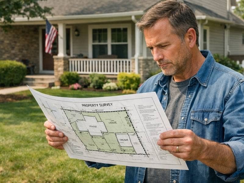
Before you call a land surveyor, it helps to know what you are walking into. Land survey cost is one of the most searched questions homeowners and buyers have, and for good reason. Prices vary quite a bit depending on what type of survey you need, and most people do not realize there is more than one kind. This article breaks down the real numbers so you know exactly what to expect.

How Much Does a Land Survey Cost?

Here is a straightforward look at average land survey costs by survey type:

  • Boundary Survey: $500 to $1,500 for a standard residential lot
  • Lot Survey: $400 to $700 for a recorded subdivision lot with existing pins
  • Topographic Survey: $1,000 to $3,500 depending on acreage and terrain
  • ALTA Survey: $2,000 to $10,000 or more for commercial properties
  • Elevation Certificate: $300 to $800 for a standard residential property
  • Construction Survey: $1,500 to $5,000 depending on project scope

These are general ranges. Your actual quote may be higher or lower depending on several factors specific to your property.

What Are You Actually Paying For?

A lot of people see the price of a land survey and wonder what takes so long. Here is where your money actually goes:

Research and record pulling. Before a surveyor ever sets foot on your property, they spend hours pulling deeds, plats, title records, and historical survey data. This office work is a significant part of the total time billed.

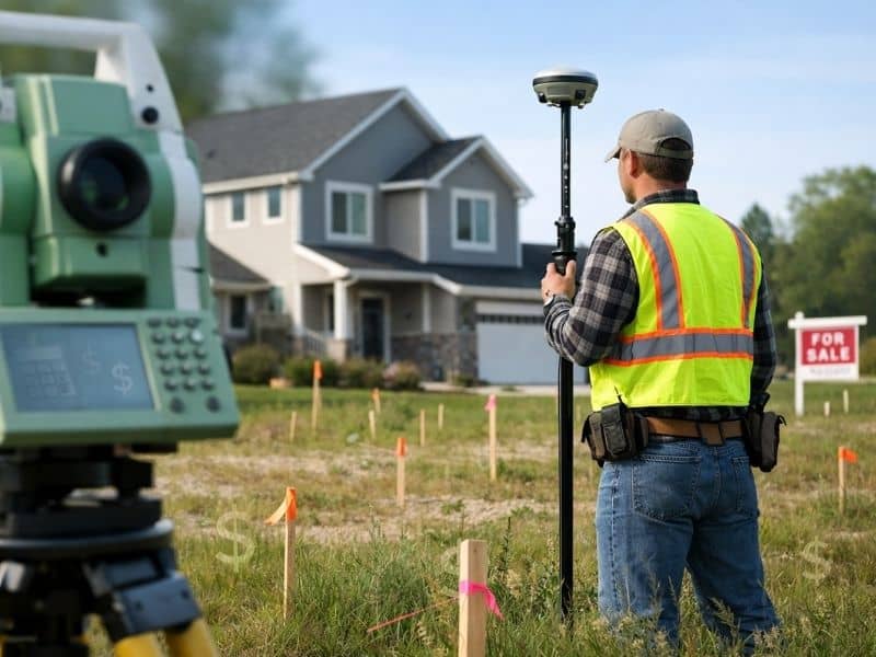
Field work. A survey crew visits the property to locate existing monuments, set new pins, and take precise measurements using GPS equipment and total stations. Depending on the size and condition of the property, this can take anywhere from a few hours to several days.

Drafting and certification. After the field work is done, the data is processed and a licensed professional land surveyor reviews, certifies, and stamps the final plat or report. That stamp carries legal weight, and it takes time to get right.

Survey Types and What Drives the Price Up

Not all surveys are priced the same, and knowing why helps you avoid surprises.

Property size. Larger parcels take more time to measure and more monuments to set. A half-acre lot costs less than a five-acre tract, even for the same type of survey.

Terrain and vegetation. Wooded, hilly, or heavily overgrown properties take longer to work through. Surveyors may need to clear sightlines, which adds labor time.

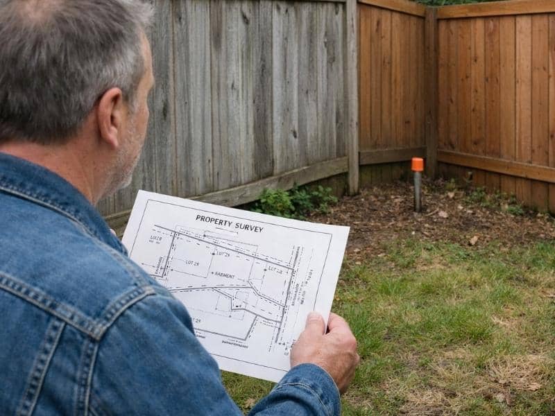
Number of existing monuments. If your property corners have never been set, or old pins have been disturbed or removed, the surveyor has to do more work to establish them. That adds to the cost.

Age and availability of records. Older properties with vague or missing deed descriptions require more research time. Rural parcels with no prior survey history are often the most expensive to work on.

Urgency. Rush orders are possible in most cases, but they come at a premium. If you have a closing deadline, contact your surveyor well in advance.

Hidden Costs People Often Overlook

There are a few things that can push your final invoice higher than the original estimate:

  • Additional monuments. If more pins need to be set than initially expected, you may be billed for the extra materials and time.
  • Title or deed issues. If the surveyor uncovers conflicting descriptions or gaps in the record chain, additional research time may be needed.
  • Re-staking fees. If someone removes or disturbs your survey pins after the work is done, you will need to pay to have them replaced.
  • Report revisions. If a lender or title company requests changes to the final document format, additional drafting time may apply.

Always ask your surveyor what scenarios could result in additional charges beyond the original quote.

Is a Cheaper Survey Worth It?

It can be tempting to go with the lowest quote you find. The problem is that a flawed survey can cost far more to fix than the money you saved upfront. Boundary disputes, incorrect building placements, and failed closings are all real consequences of inaccurate survey work.

Price should be one factor in your decision, not the only one. Ask how long the firm has been operating, whether the surveyor is licensed, and whether they carry professional liability insurance.

Frequently Asked Questions

Does the type of property affect the cost? 

Yes. Commercial properties, rural parcels, and properties with unusual shapes or complex easements cost more to survey than standard residential lots in recorded subdivisions.

Do I need a new survey if one was done recently? 

Not always. If the survey is less than five to ten years old and no changes have been made to the property, it may still be usable. Your title company or lender will usually tell you whether a new one is required.

Can I negotiate the price of a land survey? 

You can ask, but most licensed surveyors price based on time and complexity. What you can do is reduce the scope if possible, for example by providing existing deed documents or subdivision plats upfront, which reduces the research time billed.

Is a land survey tax deductible? 

In some cases, yes. If the survey is related to a business property or a real estate investment, it may qualify as a deductible expense. Consult a tax professional for advice specific to your situation.

Posted in land surveying | Tagged Land Surveying, land surveying denver

Post navigation

← Older posts
Get Quote Button
© Denver Land Surveying
Denver, Colorado
Phone: (720) 513-9667

Privacy Policy | Terms of Use

Web Development and SEO by:
SEO Company for Professionals

The owner of this website, USA Surveying & Engineering, LLC., provides coordination of professional land surveying and engineering services in all 50 states. The professional surveying and engineering services provided to you will be conducted by fully licensed professionals in your state.

↑